
Review Easley ZIP Evidence
Official postal and city evidence confirms three active Easley postal designations, but it does not supply a proven neighborhood map for each one. The table keeps the evidence narrow. It identifies the postal or civic use actually documented, then states what the evidence cannot establish. That caution matters because an Easley mailing label can be different from the municipality or county responsible for a parcel, permit, or court file.
| ZIP | Areas Covered | Post Office | Notes |
|---|---|---|---|
| 29640 | Central Easley postal and civic use is verified; a full boundary was not located. | USPS Easley Post Office, 810 S. Pendleton St., Easley, SC 29640-9998 | Confirm city and county jurisdiction with the parcel and GIS record. |
| 29641 | City Clerk mail use and a City BZA civic-address record are documented. | No official post-office detail was established in the research. | Do not call this P.O.-box-only. Its complete delivery scope and boundary need an official result or map. |
| 29642 | City facilities and a USPS routing-label source associate this designation with Easley. | No official post-office detail was established in the research. | It does not prove a neighborhood boundary, city limit, or municipal residency. |
The postal evidence makes the three labels useful research clues, not substitutes for a parcel search. A property’s situs field, a mailing field, and a recorded legal description may each use a different kind of location information.
Validate an Easley Postal ZIP
Use the official USPS address lookup with the known street address before carrying a postal label into a property or court search. Preserve the standardized address returned for that particular delivery point. The research documents a street-address and city-state result path, but it did not capture the live field labels or every interactive option. For that reason, do not infer field rules, search behavior, or a municipal boundary from the lookup screen.
The official USPS Easley Post Office detail verifies the 29640 location at 810 S. Pendleton St.
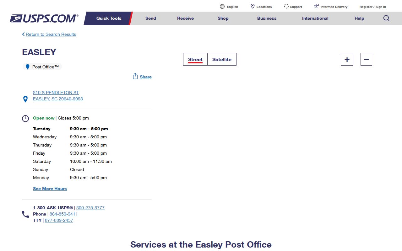
The post-office detail supports postal and civic use for 29640, but it does not draw a delivery boundary or decide whether a property is inside Easley city limits.
Note: USPS validates delivery formatting, while county and city offices determine the jurisdiction and custodian for a particular record.
Search an Easley Postal ZIP
A ZIP is only the first filter in an Easley records workflow. County property records generally work best with an address or parcel, and land records use parties, instruments, or legal descriptions. The following order keeps those systems from being mistaken for one another and avoids assuming that a ZIP-wide list exists.
- Confirm the exact delivery address in USPS Lookup and save the standardized form for that address.
- Search the Pickens assessor or GIS route by address or parcel. Record the situs municipality, parcel identifier, and county context.
- Check city limits and record responsibility with parcel or GIS information, then ask city staff about a permit, planning, or address-assignment record if needed.
- Use the Register of Deeds by party, legal description, instrument, or tax-map reference rather than assuming the postal ZIP is indexed in the deed records.
- Use the court system by county, party, case, or tax-map reference where applicable. For older address work, switch to directories, plats, maps, census material, and library resources.
Once a postal area has been narrowed to a real address, the Easley street directory provides the parcel-to-deed sequence for street-level research. A ZIP group alone does not establish the owner or occupants of every address in that group.
Separate Easley ZIP Address Keys
Postal and land records overlap, but they are not interchangeable. A proper ZIP can be attached to a mailing address while the physical parcel uses a different situs format. A tax bill may go to a correspondence address, and a deed may rely on a legal description rather than the street address. Preserve each field as the custodian labels it.
- ZIP
- A postal routing designation used with a delivery address. It is not a city-limit or parcel-jurisdiction decision.
- ZIP+4
- An added delivery-segment code used with a ZIP. It refines mail routing but does not identify a parcel owner or household.
- P.O. box ZIP
- A ZIP associated with post-office box delivery. The available Easley evidence does not establish that 29641 is limited to boxes.
- Unique ZIP
- A postal designation used for a single organization or special delivery arrangement. None is established for Easley by the research.
- Carrier route
- A postal delivery grouping. It is a mail-operation category, not a resident roll or municipal boundary.
A legal description is the recorded land key, usually a lot, block, subdivision, plat, or metes-and-bounds statement. The parcel or TMS number is the county bridge between property and mapping systems. Do not make up a Pickens number format. Copy it from the official result.
Use Easley ZIP Property Searches Carefully
The Pickens County Assessor advertises real-property search alternatives, but the research does not verify a ZIP filter. Start with an address, parcel number, account number, or owner name that is already tied to the property. A ZIP-only search can group tax-mailing and situs information in misleading ways even if a future interface offers one.
| Documented property field | Type | Search use | Limit |
|---|---|---|---|
| Owner Name | Search alternative | Find a published owner record before checking the parcel. | Owner name is not a statement of residence. |
| Property Address | Search alternative | Begin with a confirmed delivery address. | Historic and postal forms may differ. |
| Parcel Number | Search alternative | Bridge the assessor result to GIS and land research. | Use the exact county format shown by the result. |
| Account Number | Search alternative | Retrieve the property entry when an assessor identifier is known. | It is not a ZIP or a title reference. |
The official county parcel service separates owner and mailing fields from LOCADD, LOCCITY, and LOCZIP situs fields. Use that distinction to test whether a postal clue describes the physical parcel or only correspondence. No portal field should be described as a verified postal selector unless the live form documents it.
Check Easley ZIP City Limits
The official Easley Ward Map can geocode an address or place and offers a legend, layer list, map-click results, printing, measurement, and coordinate tools. It is a ward and municipal-geography tool. It is not an owner, parcel, resident, or postal-boundary database. Use the county parcel and GIS record to assess a property’s jurisdiction, then verify a city question with the relevant city office.
City permits, planning files, and municipal records should be requested only after the address and responsible jurisdiction are clear. The ward map can add municipal context, but it should not be used to infer an owner or draw ZIP lines.
Search Easley ZIP City Files
The Easley City File Directory is useful after a ZIP and address have led to a city-record question. It indexes documents, not residents or postal routes. Its documented fields are Keyword, Entity, and File Type, and its results identify Date, Title, Type, and Entity. A reader can use it to locate a permit report, plan, map, agenda, or policy before asking the right city custodian for a specific existing file.
| Documented City File Directory field | Type | What it does |
|---|---|---|
| Keyword | Text | Searches indexed city-file titles or content. |
| Entity | Multi-select | Includes Building Department, Code Enforcement, FOIA, Municipal Court, Planning & Development, Police Department, and Zoning. |
| File Type | Multi-select | Includes Agenda, Application, Audit, Budget, Fee, Form, License, Map, Minutes, Ordinance, Permit, Plan, and Report. |
| Results | Interface | Shows Date, Title, Type, and Entity. |
The official City File Directory source shows its keyword, entity, file-type, and document-result controls.
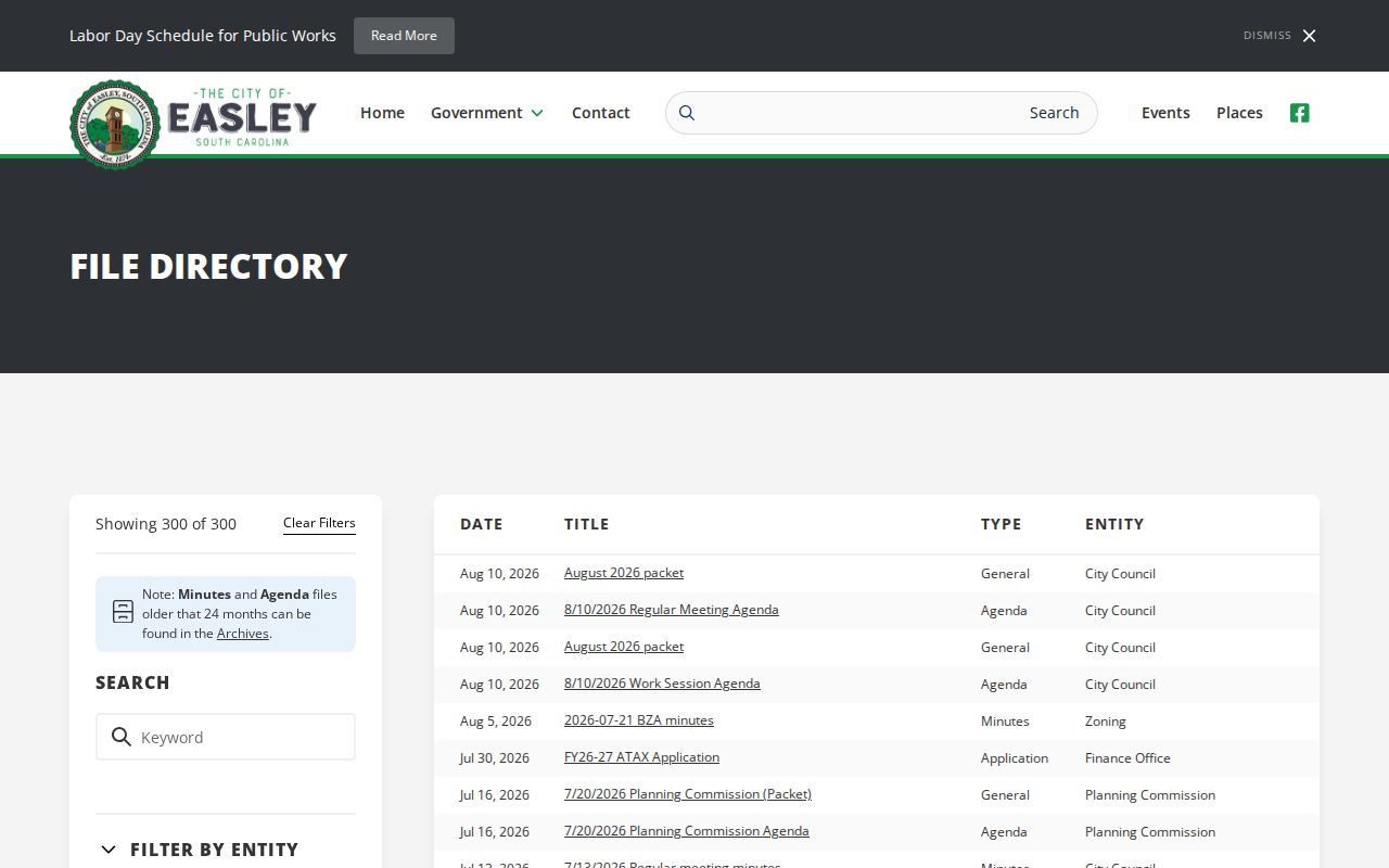
The document filters help identify an address-related city record, but the index does not provide a ZIP search, owner lookup, or resident roster.
Keep Historic Easley ZIP Limits Clear
ZIP labels should not be projected onto older Easley address history. Use the street address, legal description, plat, historical map, directory, and county name that belong to the period being researched. The Pickens County Library System warns that older material may appear under Pendleton District, Pickens District, Anderson, Pickens, or Oconee. A modern postal label can help start a search, but it cannot replace that historical geography.
The digitized Easley census recorded 3,744 people and 75 business houses on November 1, 1916. It is a valuable local snapshot, but it does not establish a modern postal boundary or a present address. The PCLS Historical Collection offers a non-circulating collection, limited obituary lookup, and a Book a Historian appointment for focused local research. Use the source date and place name beside every historic result.
Note: A historic address trail is strongest when the directory, map, parcel, plat, and deed all agree on the relevant time period.
Respect Easley Postal Boundaries
Postal records, county property records, city files, land records, and voter records have separate access rules. A postal result does not authorize a broad name search or settle who is associated with an address. For a property or city-file question, use a precise address, date, parcel number, permit number, or document title. When an online route stops, call the responsible county or city office, use the Register of Deeds counter for land books or copies, request an existing record through the applicable FOIA channel, or ask the library about historic material.
The city FOIA process accepts focused requests through its official form, email, mail, in-person delivery, and NextRequest portal. It concerns existing non-exempt records and does not require the city to create a person list or release protected information. Keep requests narrow and respect South Carolina’s address-confidentiality protections. The postal directory is not a way to identify protected people or bypass custody limits.